Brohier’s measure of Ceylon

Project Management4 hours ago2K Views

Over the past century or so, a remarkable number of people from our village, near Diyatalawa, found employment in government service. Many of them worked as assistants in the Survey Department. In the village, the department was simply known as the “Survey Office” (Saruvhar Eka), and those employed there were said to be “working at the Survey.”

The Survey Office in Diyatalawa, together with the surrounding military camps, played an important role in broadening the villagers’ literacy and their knowledge of the wider world. Survey work took many of the men across the country, into remote districts, small towns, mountain ranges and dense forests. Some spent months away from home and, on returning, occasionally brought with them a young bride from a distant village they had encountered along the way. Thus, customs, turns of phrase and family lineages from different parts of the country gradually found their way into the social fabric of our village.

According to village elders, the Survey Department once had a system under which employment could pass from father to son. Over time, the department became woven into the lives of several families, with successive generations finding their livelihoods there. For these families, the Survey was more than a government job and a monthly wage. It became a conduit through which knowledge, experience and human connections flowed between the village and the wider country.


Yet there is a fascinating piece of history that remains largely unknown, not only to most of the descendants of those who served at the Diyatalawa Survey Camp, but also to residents of the area and even to the hundreds of thousands of visitors who have travelled to Diyatalawa and Bandarawela.

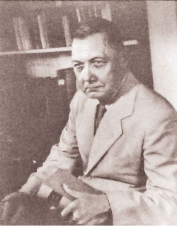
Dr. R. L. Brohier

That fact is the existence of a Survey Museum in Diyatalawa, now known as the Dr. R. L. Brohier Museum.


There is another remarkable detail that remains largely unknown even among the thousands of members of the Institution of Engineers, Sri Lanka. In 1956, a surveyor without an  engineering degree became president of the institution’s predecessor, the  Engineering Association. His name was Richard Leslie Brohier, better known as R. L. Brohier.


Born on October 5, 1892, Brohier joined the Survey Department in 1910 and is recorded as its first Sri Lankan surveyor. His family traced its ancestry to European origins, yet a reading of his life leaves little doubt that his deepest allegiance was to the island he spent his life studying, documenting and celebrating.


If I were ever asked to name the surveyor who rendered the greatest service to Sri Lanka, my answer would come without hesitation: R. L. Brohier.


But “surveyor” alone hardly begins to describe him. He was a historian and researcher, an attentive observer of archaeology and human life, a travel writer, a man deeply attuned to the natural world and, above all, a gifted writer who seemed to read the island’s character in its landscapes, ruins, villages and people, and then reveal it to the wider world.

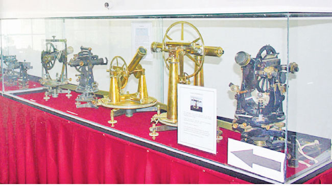
Today, land can be surveyed within minutes using GPS, drones and satellite technology. A century ago, however, the men who mapped the country had little more than a theodolite, a measuring chain, a notebook and an extraordinary measure of courage.


The Survey Department is one of Sri Lanka’s oldest state institutions, established more than two centuries ago. Its work extended far beyond the drawing of maps and the marking of boundaries. Roads, railways, irrigation schemes and urban settlements all depended on the knowledge it produced. Before a road could be built, a reservoir planned or a railway laid, the land itself had to be understood.

In that sense, the surveyor was the scientist who read the terrain before the engineer arrived.


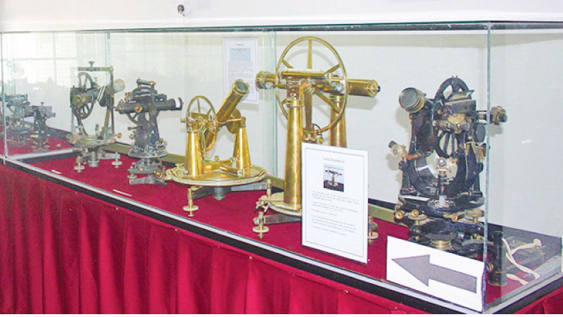
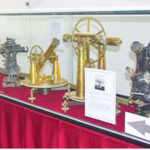
Walking among the old theodolites, plane tables, measuring chains, maps, photographs and other instruments preserved at the Diyatalawa Survey Museum, one can glimpse a fragment of this long history. These are not merely obsolete pieces of equipment. They are silent witnesses to a generation that mapped the island, inch by painstaking inch.


The ordinary surveyor measured the length and breadth of the land, translating the physical terrain into the lines and contours of a two-dimensional map. Brohier went further. He brought into that map the people who inhabited the land, along with their folklore, customs, ways of life, irrigation traditions and history.


Seen in that light, Brohier did more than measure the terrain. He gave it a human dimension, turning the survey of a country into something closer to a three-dimensional reading of the land itself. And what he encountered in that journey, he recorded with an uncommon gift for observation and an extraordinary command of the written word.


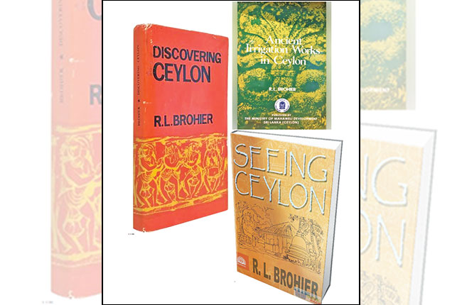
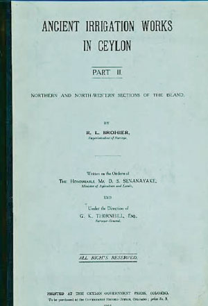
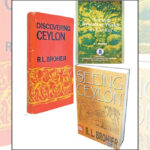
Those observations later returned to us in works such as Seeing Ceylon, Discovering Ceylon, Ancient Irrigation Works in Ceylon and Changing Face of Colombo. When writing about an ancient reservoir, Brohier does more than preserve its folklore. He studies the position of the tank bund, the movement of water, the network of canals and the relationship between engineering and terrain through the trained eye of a surveyor. His books, therefore, are more than travelogues. They are records in which the land and its people are read together.


I came across a detail about Brohier that I had not known during my first visits to the Institution of Engineers, Sri Lanka. One day, as I stood before the row of portraits of its former presidents, I noticed Brohier’s imposing likeness among them. For a moment, I was taken aback.


“Was Brohier an engineer?”


The question came instinctively. To discover that a surveyor without an engineering degree had risen to the presidency of the institution’s predecessor, the Engineering Association, struck me as a remarkable recognition of his scholarship, professional standing and contribution to the country.


If Martin Wickramasinghe gave Sri Lanka’s village life and its people an enduring voice in Sinhala, Brohier carried the island’s rural landscapes, heritage and ways of life to a wider world in English.


The Diyatalawa museum could, with further development and promotion, become an important cultural and educational attraction for both the public and visitors. Brohier’s European ancestry, his life as a surveyor, the history of Sri Lanka’s irrigation systems and the rich body of writing he left behind could be brought together there as parts of a single, compelling story.


It could then become more than a repository of old surveying instruments. It could be a living centre of memory, telling the story of the men who mapped Sri Lanka and helping visitors, local and foreign alike, understand the country through the eyes of those who first measured it.


There is much more to say about Brohier. As a surveyor, he mapped the island’s terrain; as a writer, he filled that terrain with people, history and memory.


And that is why I return to my earlier assertion: if Sri Lanka were to name the surveyor to whom it owes the greatest debt, my choice would still be R. L. Brohier.


I will return to his story another day.

Old surveyor’s equipment at the museum

Written by:

Eng. Tilakasiri Ekanayaka

PMP(PMI-USA), PMI-RMP, PMI ATPI , MBA, B.Sc. Eng., Chartered Engineer , PMO Lead Procons Group

Leave a reply

Loading Next Post...
Follow
Search Trending
Loading

Signing-in 3 seconds...

Signing-up 3 seconds...